

Chicken Tramper Ultralight Gear
Hiking Trail Map
Myrmel Maps, Created by Minnesota world traveler, artist/cartographer Keith Myrmel of Myrmel Maps.
These detailed hiking trail maps are a statement piece for those who have camped, hiked or adventured on the trails! We have three map options available, keeping our heart close to home here in the Midwest.
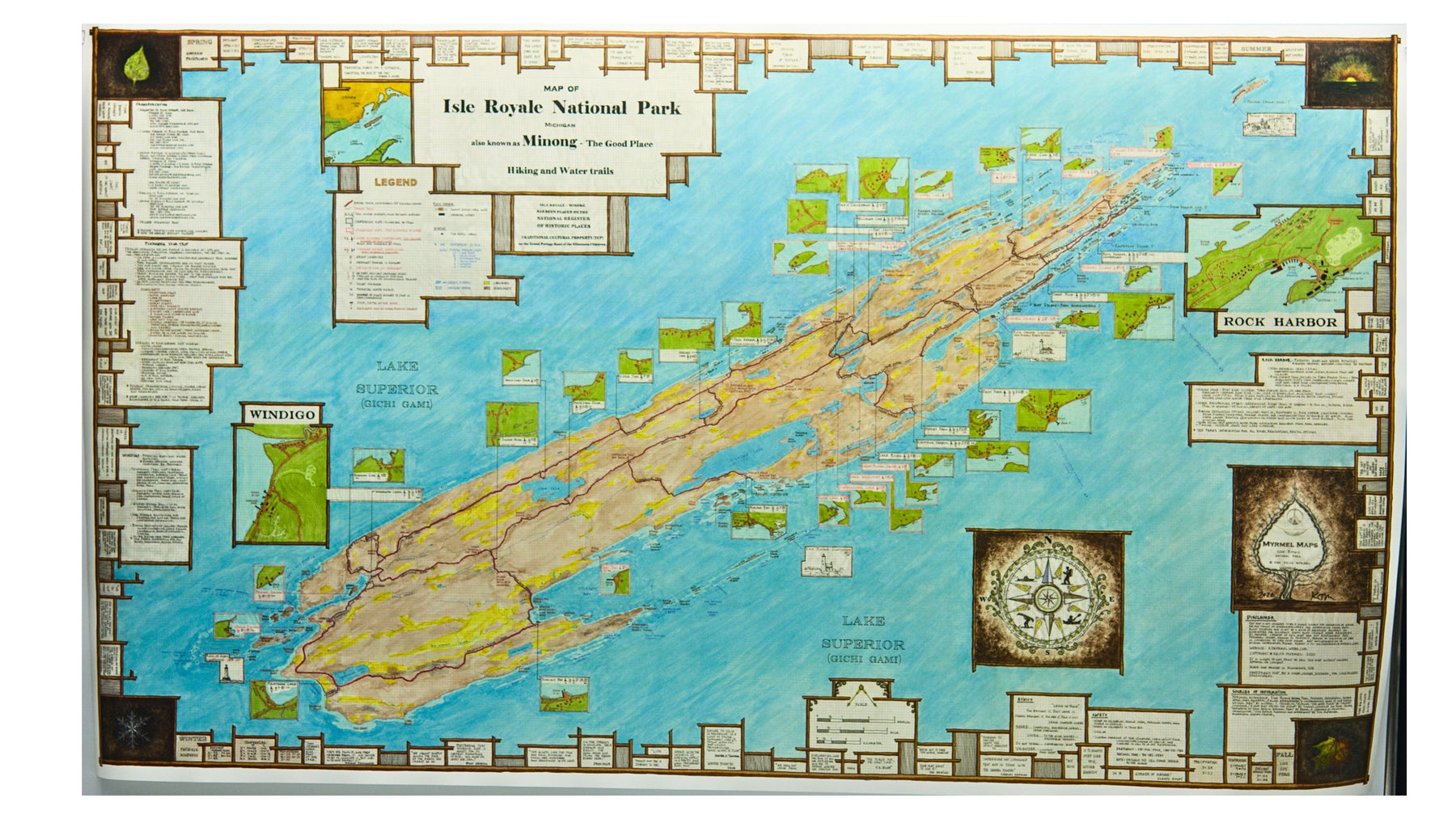
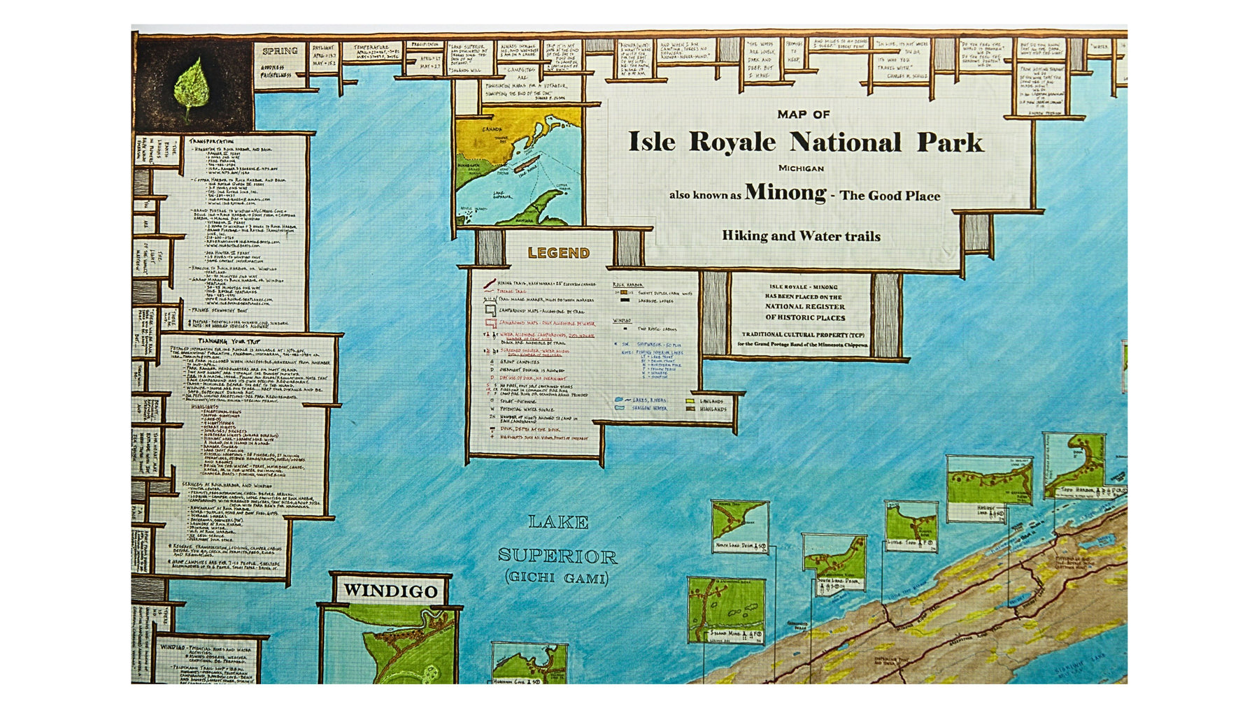
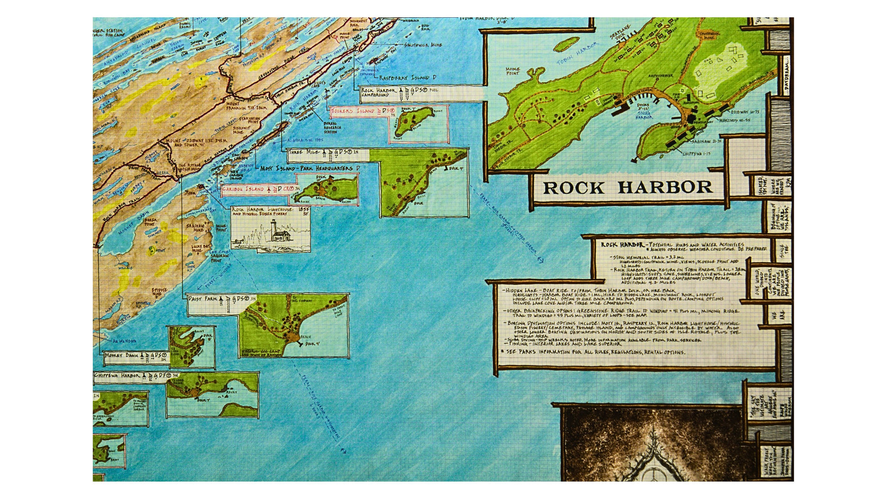
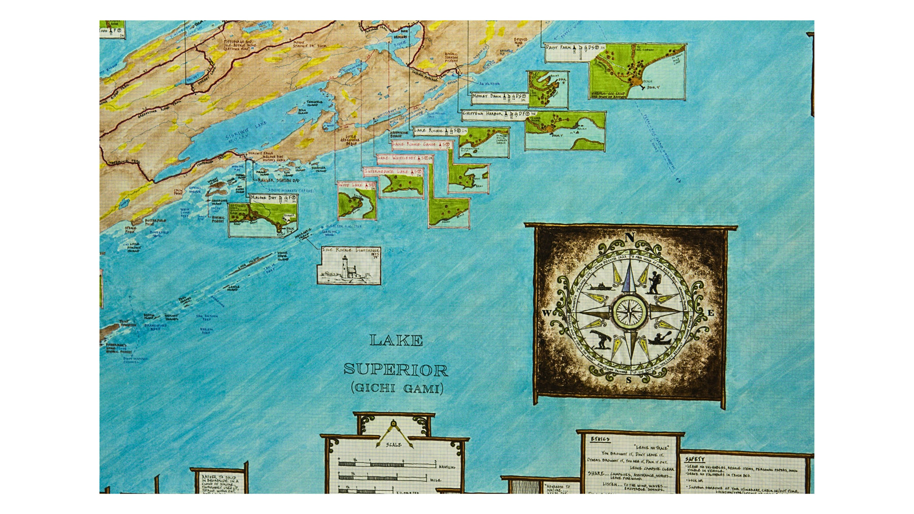
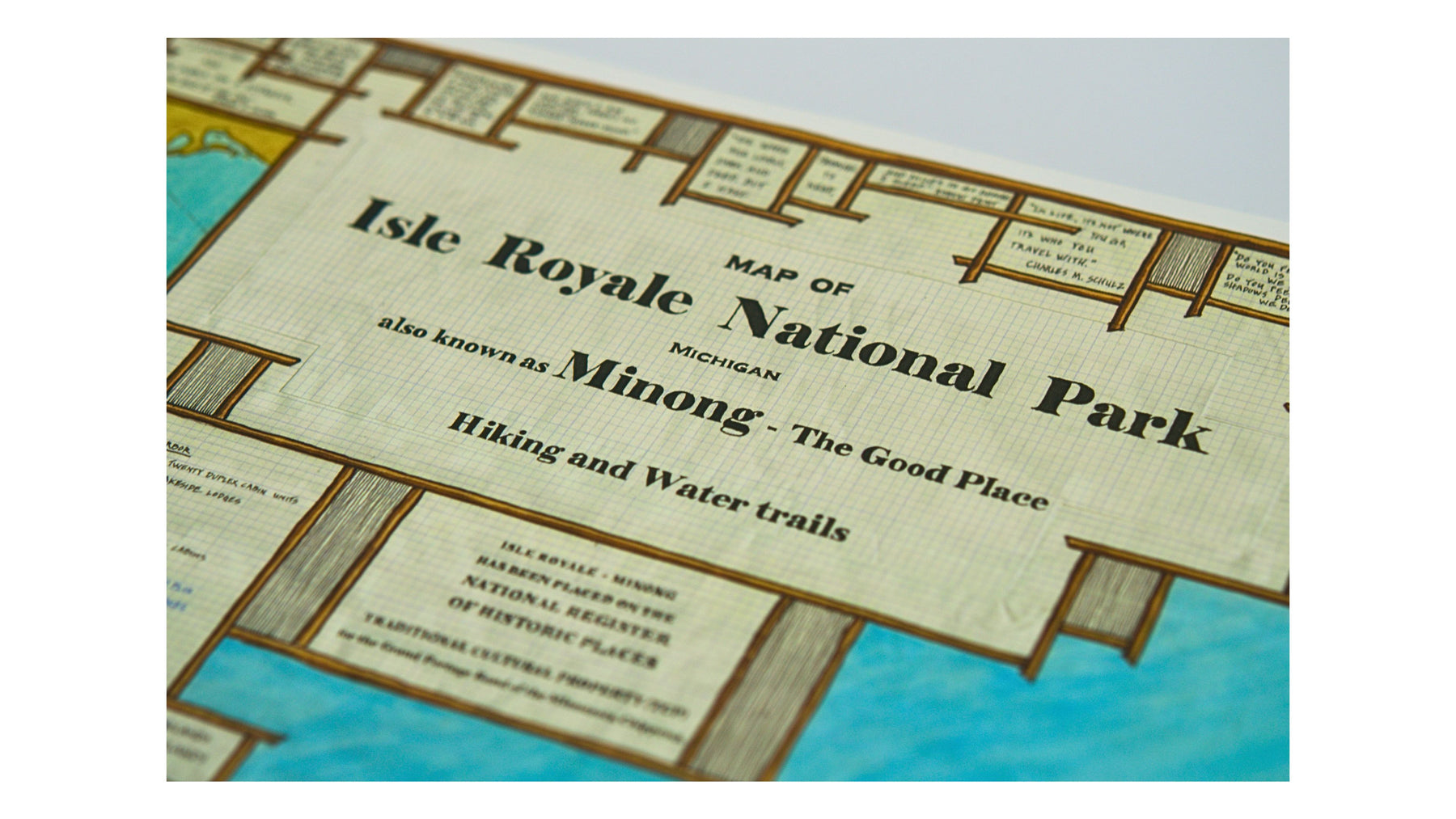
Isle Royale Map
This Map of Isle Royale in Lake Superior is the only complete map showing every campground and all information for shelters, tent sites, toilets, fire options, number of nights, dock and depth.
Map size = 23" x 39"
This map is waterproof.
Printed in 2020
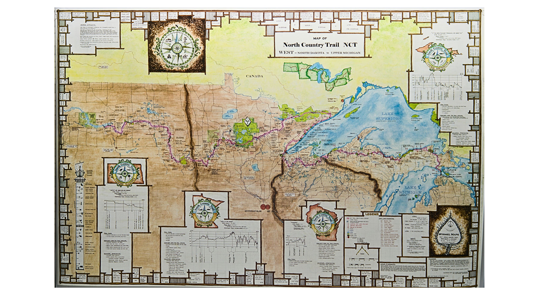
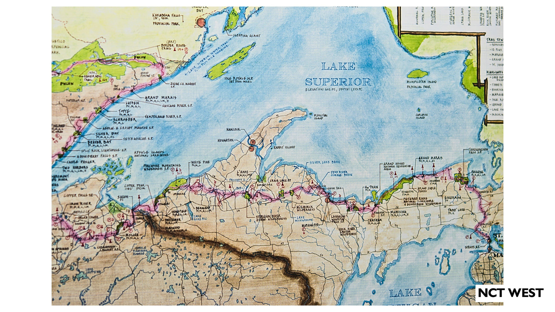
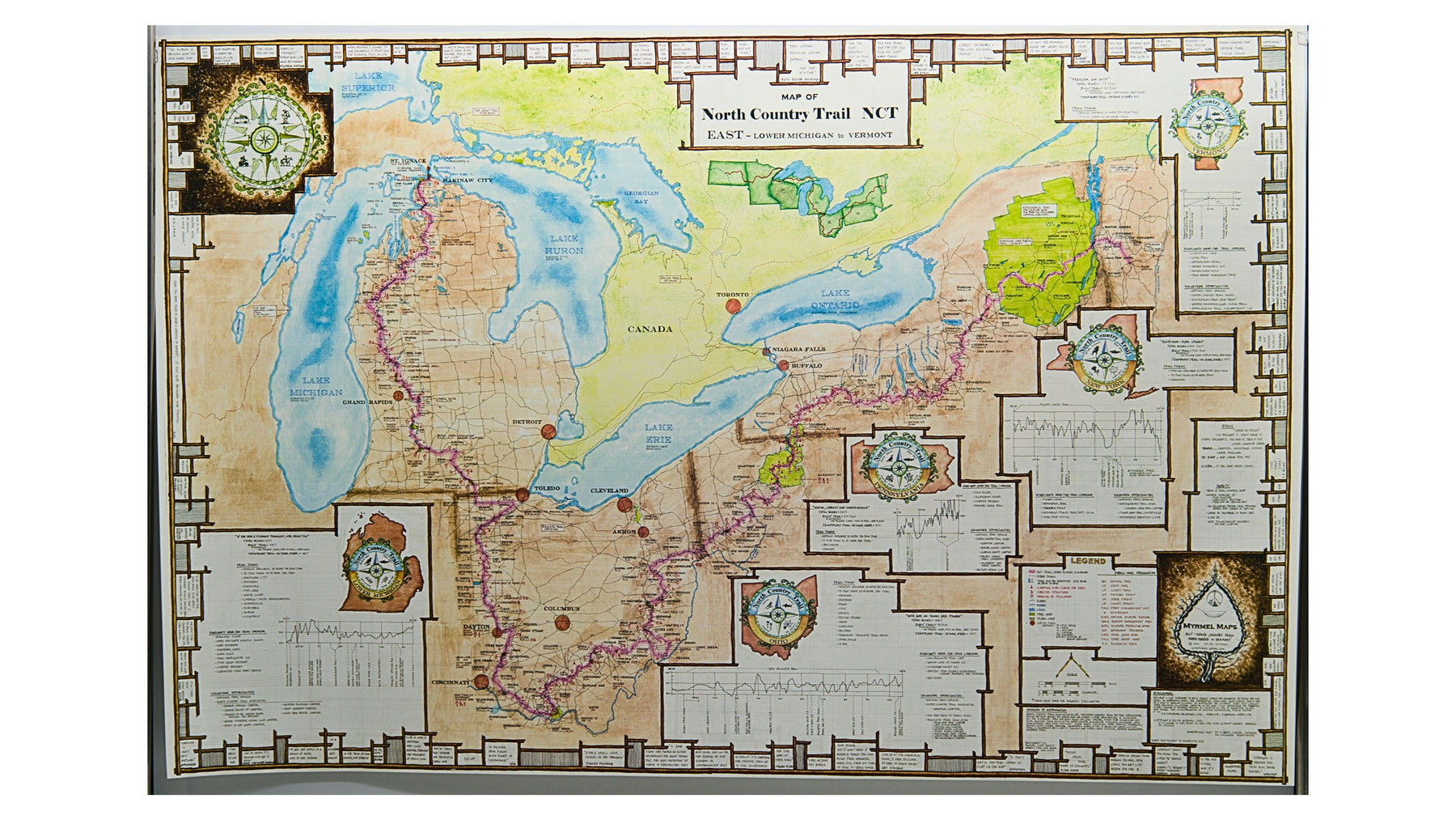
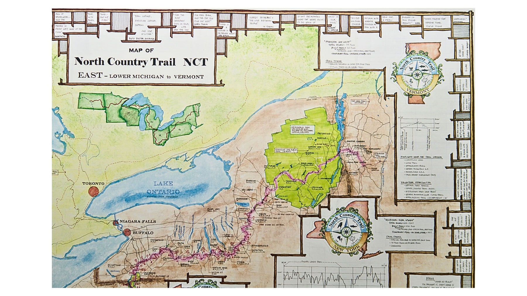
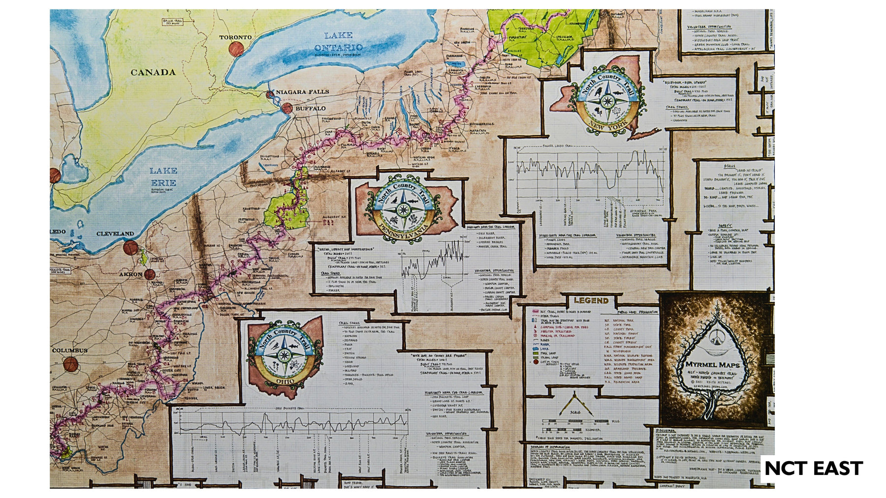
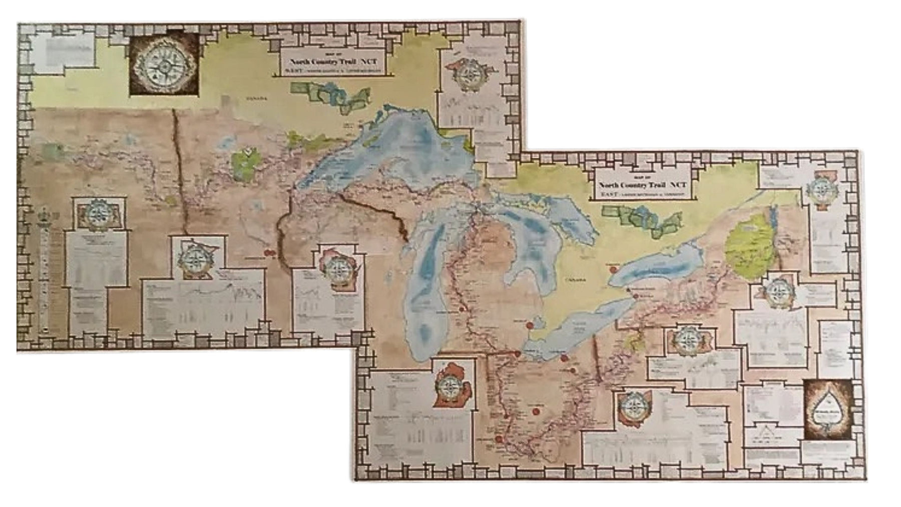
North Country Trail Map
This map of the North Country National Scenic Trail is double sided, with both the Eastern and Western side, you get to pick which side you display! The NCT is the longest National trail, 4,800 miles, from North Dakota to Vermont. This waterproof map, printed on both sides of the paper, shows details for each State the trail passes through and connections on the east with the Vermont Long Trail and Appalachian Trail, and on the west end to the Louis and Clark Trail via the Missouri River.
This map overlaps like a puzzle piece with the North Country Trail Map West. If you buy two, overlap together for the full map display! Offset map as shown.
Map size = 25" x 39"
Printed 2021